
At first glance, the Anchor River seems remote and wild. After all, Anchor Point is small, even by Alaska standards, and the river’s headwater streams fan out into wetlands and the hilly hinterlands of the south peninsula.
But the river’s valued fish runs are struggling, and for years observers have expressed concern about the watershed’s health. Efforts to address those concerns are getting results thanks to hard work by an array of groups partnering to protect the river’s resources.
A March 5 field trip was a chance to review threats to the river, past successes and to hear about future plans for the watershed.
Mandy Bernard, conservation director for the Kachemak Heritage Land Trust (KHLT), and Sue Mauger, science director for Cook Inletkeeper, led the tour, with assistance from several biologists.
On a mild winter day, about a dozen people joined them to look at the river, adjacent conservation property and sensors used to monitor its condition.
Bernard and Mauger focused on how the land trust is using recent scientific findings to prioritize its conservation activities. The mission of the trust, which began in 1989, is to preserve, for public benefit, land with significant natural, recreational or cultural values by working with willing landowners. In recent years, the group expanded its mission beyond the Homer area to the entire Kenai Peninsula.
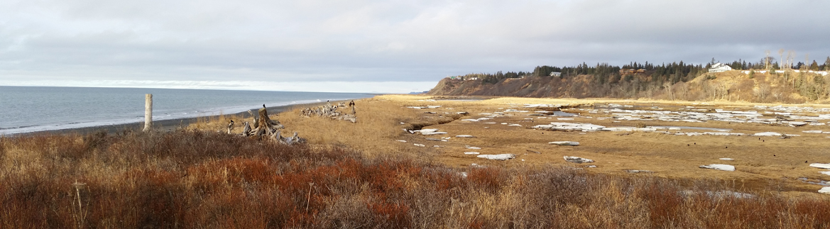
The Anchor River produces king (chinook), silver (coho) and pink salmon as well as Dolly Varden char and one of the state’s northernmost steelhead populations. Juvenile salmon spend one to several years in the Anchor, not only in the main river but also in tributary streams and meandering side channels.
In addition to these popular food and game fish, the 125,000-acre watershed provides prime habitat for wildlife such as moose and bald eagles.
In 2012, the National Fish Habitat Partnership named the Anchor River to its nationwide list of top 10 “Waters to Watch.” Last summer, the Alaska Department of Fish and Game limited fishing on the river, a common occurrence in recent years. “Anchor River king salmon runs have been well below average since 2009,” the agency noted in a June 2014 press release.
Although development in the area is diffuse and often hidden up back roads, the watershed is quite built-up relative to other systems that host healthy salmon runs. Stresses on the ecosystem include gravel pits (that change drainage patterns) and the spruce-bark beetles’ destruction of spruce forests (that change shade and vegetation).
The Anchor is the only major salmon watershed on the Kenai Peninsula that lies completely outside the protected federal lands of the Kenai National Wildlife Refuge or Chugach National Forest. It also is unusual in lacking any glacier input, a fact that makes it more vulnerable to warming that can harm cold-water fish.
“This system seems to be quite sensitive,” Mauger said. “When we have warm summers, it warms up quite quickly.”
Mauger heads up a project that monitors water temperatures in area rivers, temperatures that sometimes exceed the limits for juvenile salmon to thrive. Recorded water temperatures below the Old Sterling Highway bridge have spiked above 59 degrees Fahrenheit, the threshold for damaging salmon survival, but so far not above 68 degrees, which fisheries biologists consider lethal to salmon. Cook Inletkeeper has been logging water temperatures in the river since 2002.
Without glacial melt, what keeps the Anchor River cool?
Groundwater plays a big role, the scientists found, in buffering the water temperatures. Upwelling keeps some areas warm in winter and cool in summer. Such areas are called thermal refugia. Groundwater input prevents fish from suffocating under ice in winter, keeps them from overheating on sunny summer days, and also provides nutrients that enhance aquatic productivity.
Stakeholders decided that preserving property adjacent to those springs was a priority. Cook Inletkeeper hired a contractor, Watershed Sciences, Inc., to fly over the river in 2010 and 2012 with a specialized thermal infrared camera to translate heat to digital imagery along about 70 miles of the river.
Portions of the Ninilchik River also were photographed. The results, backed up with field testing, allowed them to pinpoint parts of the river that provide critical cool spots for fish in summer.
This is not the first or last project to target Anchor River habitat. Conservation efforts date back at least until 1985, when the upper reaches of the river’s south fork were purchased by the state Department of Natural Resources and included in the Anchor River/Fritz Creek Critical Habitat Area.
About 2000, the land trust partnered with The Nature Conservancy of Alaska, which got federal grant funding from the U.S. Fish and Wildlife Service (USFWS) designated for preservation of coastal and wetlands habitat. They developed detailed maps combining habitat characteristics and landownership information to set purchase priorities. The project also provided outreach to raise public awareness of threats to the river and of conservation options. The land trust used the information and leveraged grant funding to obtain donations or discounts on priority parcels.
The first big success for the targeted land acquisition was in 2000, when Mark and Deborah Starr donated about 56 acres of low, riverfront land near Blackwater Bend to the land trust. The field trip stopped at the Starr property, where state biologists showed participants fish plucked from the icy waters, including juvenile salmon that winter on the site. Since 2000, KHLT has acquired five other undeveloped riverfront parcels, the most recent just this month. More transfers are under discussion.
The trust and conservancy also completed, after multi-year negotiations, the transfer of large parcels in the estuary from private ownership to the state. The move protects not only habitat but also public access to popular angling sites.
In 2007, the Homer Soil and Water Conservation District and Cook Inletkeeper issued the Anchor River Watershed Action Plan. That identified additional concerns such as erosion, failing culverts, and creek damage by off-road vehicles.
The thermal infrared mapping is just the latest tool that river stewards such as KHLT and Cook Inletkeeper are using to plan effective conservation. Other partners involved in the Anchor River efforts in recent years include the Kachemak Bay Research Reserve, ADFG, USFWS, the Soil and Water Conservation District, the Kenai Peninsula Fish Habitat Partnership, the Kenai Watershed Forum, The Nature Conservancy, the “Exxon Valdez” oil spill trustee council, The Conservation Fund and the individuals who have contributed land and funds to the effort.
The field trip was held in conjunction with the Kachemak Bay Science Conference and the Kenai Peninsula Fish Habitat Partnership meeting. The cooperation between recent river studies and the land trust’s Anchor River project exemplifies the conference’s theme: linking science to management.
Shana Loshbaugh is a freelance writer who lives on the southern Kenai Peninsula. Her background includes biology, history and journalism.
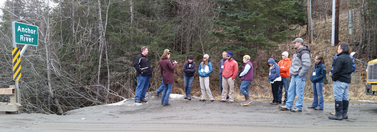
On March 5, about a dozen people from the Kachemak Bay Science Conference attended a field trip to the Anchor River to look at habitat and conservation projects. Sue Mauger, a scientist with Cook Inletkeeper, second from left, was one of the tour leaders.-Photos by Shana Loshbaugh
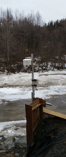
Modern sensors, such as this one (at left) along the Anchor River, monitor weather and river conditions. The information uploads to satellites.-Photos by Shana Loshbaugh
