
At first glance, the idea of a Kachemak Bay Water Trail seems bizarre. Is that a long, skinny canal like in France? Do buoys bob in the bay showing the exact path a mariner would take to go from Bear Cove to Seldovia?
Nope. It’s not even a long river paddle like the Moose River from the Swanson Lakes to the Kenai River or the Boundary Waters trail in Minnesota. Rather than one trail or even a series of trails, the Kachemak Bay Water Trail is a tool to explore the coasts, coves and fiords of Kachemak Bay and around the corner to Seldovia, all 125 miles of it.
On Friday, dignitaries from Alaska State Parks, the U.S. Department of Interior, the National Park Service and the National Oceanic and Atmospheric Administration visit Seldovia and Homer for official ribbon-cutting ceremonies.
The Seldovia event is noon-2 p.m. at the boat harbor boat launch.
The Homer event is 5 to 8 p.m. at the Pier One Theatre beach and kayak launching site — the start of the trail.
So what is the trail? A map tells the story best.
Marked along the way are launch sites, kayak beach landings, mooring buoys, campsites, cabins and yurts, trail heads, private lodgings and other facilities mariners might want as they paddle or boat around the bay. An interactive map on the water trail’s website at www.kachemakbaywatertrail.org includes descriptions of these sites, geographical coordinates, and tabs to add photos and comments.
“We’re just providing a mechanism so people can see what’s available,” said Robert Archibald, a member of the steering committee that helped develop the water trail. “They can pick where they want to go, where they want to stop, according to the time. There’s a link on the website that can give them the weather, the tides.”
Dave Brann, a longtime volunteer for local and state parks, was the inspiration behind the project. He was attending his 50th high school reunion back east and unavailable for an interview for this story.
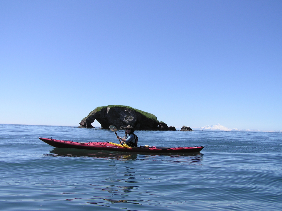
An adventurous kayaker could do the entire system, starting at the Pier One beach, going around Mud Bay and up to the head of the bay, over to Bear Cove, and then up the coast past Halibut Cove, through Eldred Passage and along the south side of the bay and around the point to Seldovia. Whew.
More likely, though, mariners will choose shorter routes for on- or two-day trips.
“There’s places you can go, although you have to be careful where you go with the exposed weather around here,” said Karl Stoltzfus, owner of Bay Excursions and a water taxi operator. He suggested protected areas like Tutka Bay and Sadie Cove.
That’s one point Archibald stressed: safety. With the notorious bay breezes, Kachemak Bay can be challenging to cross in the afternoon, but a delight in the flat calm of a late summer evening. Archibald said some people have gone out into the bay and lost their lives by doing stupid things, like paddling in a canoe or going when the weather and tide isn’t right.
“We’re advocating that first timers and novices go with a guide outfit. Don’t try to go around all the way. Go around the other side where you have protected waters,” Archibald said. “We have a major caveat at the beginning. If you don’t use your head, you can lose your life out there, which has happened before. Be smart. Be safe.”
The water trail will have a brochure that discusses safety, “Your guide for safely navigating the Kachemak Bay Water Trail.” It emphasizes things like filing a float plan, wearing a personal floatation device, carrying signaling devices, keeping a marine VHF radio or a cell phone in a waterproof bag, and watching the tides and weather.
Allison O’Hara, owner of True North Kayak Adventures, suggested some short trips for the moderate to experienced kayaker. One trip is to start on Yukon Island, go into Tutka Bay, go into China Poot Bay, portage over to Peterson Bay, come out into Halibut Cove and then get picked up by a water taxi at Glacier Spit.
“I’ve had a lot of people do that before it was the water trail,” she said.
Some of those waters can be challenging, though, such as China Poot Bay or the day breeze on Sadie Cove. A more moderate loop is around Yukon Island, a guided tour True North does out of its base camp on Alaska Maritime National Wildlife Refuge land on the island. That trip passes by natural wonders like Elephant Rock and includes good beach landings.
O’Hara also suggested going to the head of the bay. A kayaker could take a truck down the switchbacks at the end of East End Road to Kachemak Selo and put in there. Those areas can be muddy, though, and kayakers would want to launch on the high tide.
But what if a kayaker doesn’t want to drive down the switchback road? An enterprising East End Road resident might see an opportunity in doing kayak launchings at Kachemak Selo. That’s one aspect of the water trail Archibald and its backers hope to see developed.
“At other water trails there have been major opportunities for businesses once they see the need for a service,” he said. Some entrepreneurs have asked about starting B&Bs to cater to people using the water trail, Archibald said.
Water trail organizers have been careful to respect private property. Maps also show places with private property where people cannot camp and where beach landings should be made only in emergencies. Private property where water trail users are welcome will be marked with Kachemak Bay Water Trail signs.
“People who are being pessimistic about this whole thing should realize we’re advocating for the private landowner, and to make the notation that the landowner is not receptive to having kayakers,” Archibald said.
The water trail web site, designed by Tom Kerns of Tundra Technologies, allows for businesses to apply to add their services.
“They can go through a one-stop shop and get as much information and links that provide them with that,” Archibald said.
Organizers said they hope the water trail also will spur public improvements, like better mooring buoys and increased maintenance of campsites.
For O’Hara, the water trail already fits in with what she does in her kayak tours.
“We already stop and camp at all the beaches that are part of the water trail,” she said. “I think that having the word get out about those awesome, longer trips, a progressive paddle — it will get the word out to people what is possible.”
“It doesn’t happen overnight,” Archibald said. “It takes a while for it to mature. Right now we’re going through the growing pains.”
Michael Armstrong can be reached at michael.armstrong@homernews.com.
Kachemak Bay Water Trail Ribbon-cutting and Dedication Friday
Noon-2 p.m., Seldovia harbor boat ramp
5-8 p.m., Homer, Pier One Theatre beach and kayak launching site
Food and drink, paddling demonstrations, and sea chantey sing-alongs. An official map of the trail and brochures will be available.
Joshua Duffus’ “A Recreational Guide to Kachemak Bay State Park and Wilderness Park” will be available for sale.
What: A 125-mile route in Kachemak Bay and lower Cook Inlet
Why: To map and identify public use cabins, camping sites, trail heads, moorings, kayak landing sites and other facilities along the coastline and islands of the bay
Who: Kachemak Bay Water Trail and Friends of Kachemak Bay State Park
For more information: visit www.kachemakbaywatertrail.org
