‘What’s in a name?’: Reviving a forgotten past — Part 7
Published 1:30 am Thursday, March 26, 2026


AUTHOR’S NOTE: This is the seventh and final chapter in a multi-part series about Kenai Peninsula places and landmarks that once had different names. Previously, the series has discussed Sterling, Soldotna, Cooper Landing, Tern Lake, and various other peaks, streams and lakes on the Kenai.
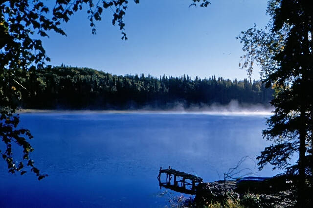
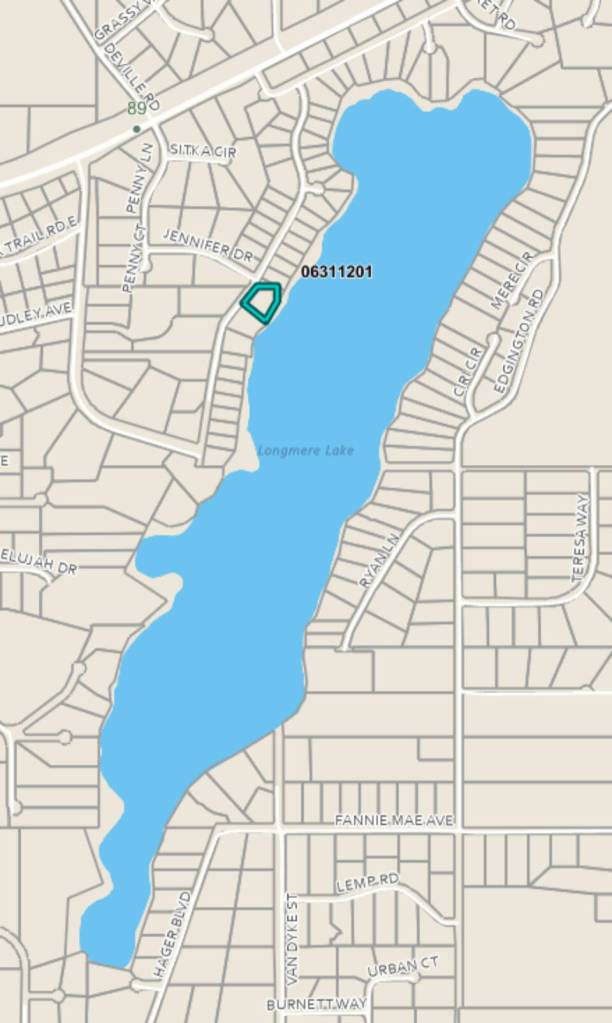
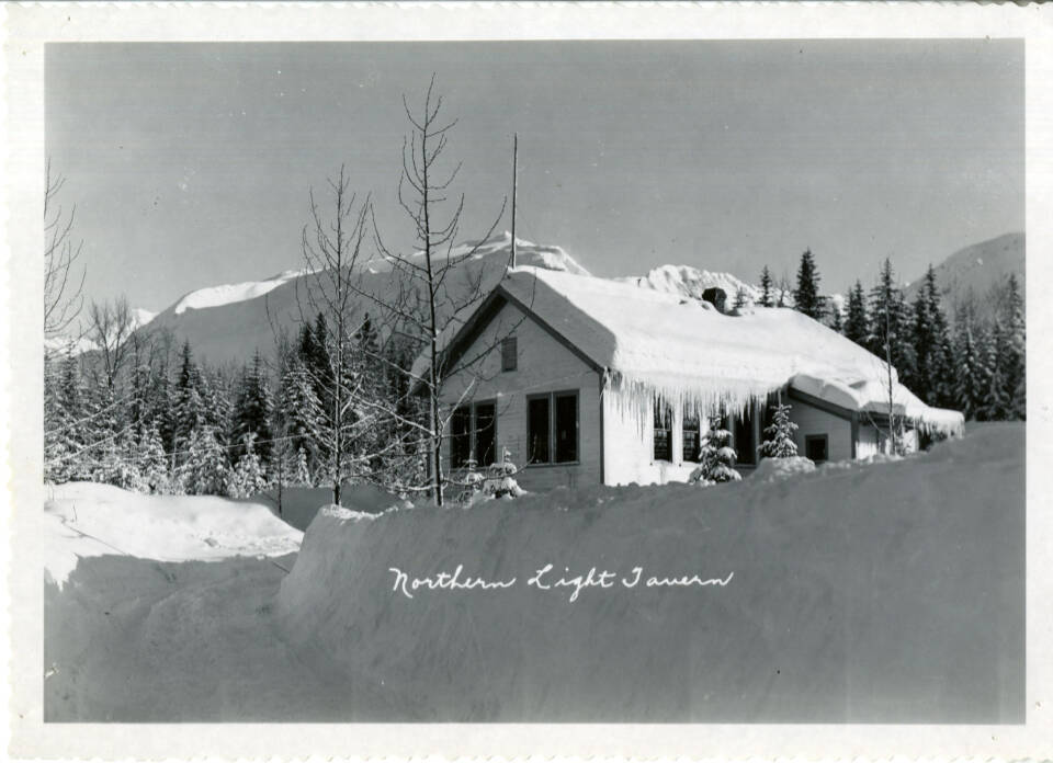
Around Longmere Lake today, more than 100 individual parcels of land make contact with the waterline. The largest of these parcels is 9.95 acres. The smallest is a triangular sliver of only 0.07 acres. In the spring of 1947, however, the lakeshore was unbroken by property lines, except for a single parcel of land—a 167.29-acre homestead along the northwest shoreline.
Back then, a lone white canvas tent was the only sign of civilization along the 1.5-mile-long body of fresh water running diagonally from northeast to southwest.
In 1947, the Alaska Road Commission—which may have provided the earlier, punny-sounding name, DeLong Lake—had cleared a pioneer trail suitable for Caterpillars and other road-building equipment less than 500 feet from the lake’s northernmost shore.
This trail would one day be a permanent road—the Sterling Highway—from Cooper Landing to Homer, with a junction near the mouth of Soldotna Creek, where homesteading land was just becoming available. Don Culver, the single man in that white canvas tent, liked this situation.
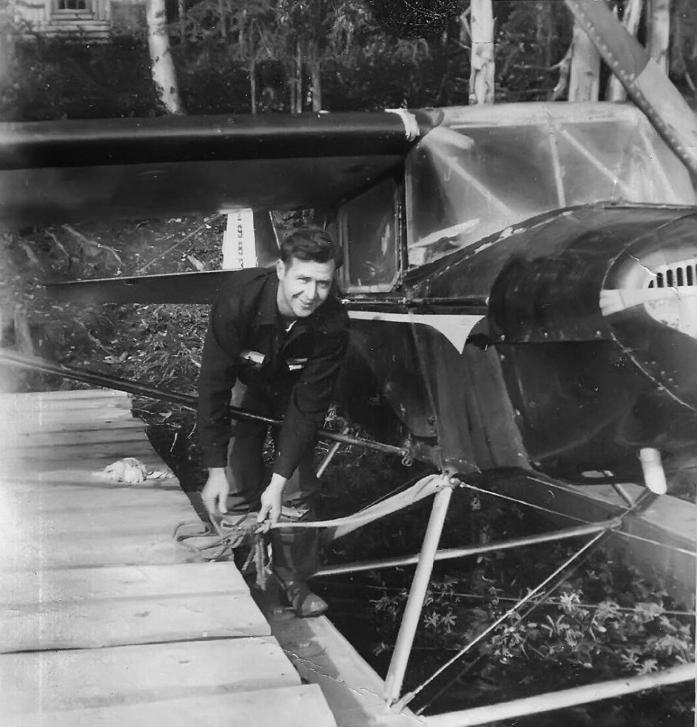
Culver, a pilot, was just 20 years old when he landed on the lake for the first time, drawn to the location by a chance meeting with a friend of his father, Ben Culver, an Anchorage realtor. The friend was Hawley Sterling, assistant engineer for the aforementioned highway project and the man for whom the highway and the town of Sterling would be named.
“Hawley told my dad that while he was in the process of surveying,” said Don Culver, “he had camped on this lake, and that if he wasn’t involved in something else, it was a place he’d love to settle…. [He] had a survey map, and he gave us a copy of it. And it showed this lake. [Officially] the survey had not been published as such, but he had the information and the location, and I had a fresh pilot’s license.”
In mid-March of 1947, Don and Ben Culver paid a visit to Jack Carr’s Flying Service at Merrill Field and rented a single-engine airplane affixed with snow-skis. They flew south and located the lake about five air miles west of the wooden bridge over the Moose River near its confluence with the Kenai River. After they viewed from the air the snowy survey lines, they landed on the frozen lake surface and used the survey map to locate corner posts and stake out a homestead claim.
“We did the old miners’ thing of taking a Prince Albert tobacco can and nailing it to a tree,” he said. “We put my claim in there and made a copy of it and went back to Anchorage to the District Land Office and filed it with the clerk.”
The romanticized name for the lake, Longmere, was Ben Culver’s contribution, according to his son: “Because of its shape—a long lake—and because he had some old Scottish history—‘mere’ being an Old English word for water or pond or lake—‘Longmere’ came out of that.”
By the end of June, Culver was in cabin-building mode and had laid in about three courses of logs. He had ordered materials that he would need as construction progressed: framed glass windows, eight-inch shiplap for the floor and roof, aluminum roofing, and a stovepipe, among other items. During that dry June, however, a spark that kindled near Hidden Lake (almost 20 miles to the east) broke out into a conflagration that threatened Culver’s construction venture and his peaceful new existence.
By late July, the 1947 Kenai Burn had blackened nearly 300,000 acres of central peninsula lowlands and was moving relentlessly westward. Culver found it necessary to take action. “I took all my camp and buried the stuff—made a pit and covered it over so it wouldn’t burn, and I put foodstuffs and other things up on the cache [he’d built].” Then he left his belongings and joined some military personnel traveling through the area looking for people who needed help.
During his 10-day absence, the massive fire began to die at last. When Culver returned to his homestead, he discovered that that he had been lucky: The blaze had barely encroached on the eastern edge of his property before dissipating. Parts of the forest around continued to smolder as he renewed his building project.
Shk’ituk’t
Originally the village at the river mouth was known to the Dena’ina as Shk’ituk’t, and the river itself was known as Kahtnu. The inhabitants of the village were Athabaskan Indians who called themselves Kahtnuht’ana, which translates as “people of the Kahtnu.”
The Alutiiq people of the Kenai Peninsula called these people Kenaiyut, which translates as “people of the Kenai River.” It is this Alutiiq term that the Russians adopted to refer to the Dena’ina, calling them “Kenaitze.” This Russified term became the source of the city’s name.
In 1791 the Russians also constructed a fort on the bluff above the mouth of the Kenai River. They called this fortification “Redut Svataya Nikolaya,” meaning Fort St. Nicholas. After the United States purchased the Alaska Territory from Russia in 1867, the U.S. military established its own post there and called it “Fort Kenai” or “Fort Kenay” for the Natives living in the area. In 1899, the first mail service was established there as the Kenai Post Office.
Roosevelt
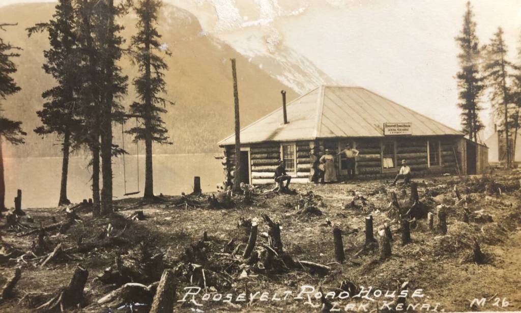
Dr. David H. Sleem’s 1910 “Map of Kenai Mining District and Moose Pass Regions” shows the location of Roosevelt near the outlet of Ptarmigan Creek on Kenai Lake. Almost certainly named for Theodore Roosevelt, who was the U.S. President at the time railroad construction began in Seward in 1903, Roosevelt, at about railway mile 23, became the site of a popular roadhouse run by Albert and Anne Roberts.
Before the roadhouse began operating, the Alaska Central Railway, which likely gave Roosevelt its name, constructed there a siding—a secondary track off the main line, used for train storage, passing, loading and unloading. In about 1910, the ACR also erected a rail station there.
Prior to the Robertses, William Abbott ran the roadhouse at Roosevelt and then moved to Seward. In June 1912, Al Roberts became the first postmaster at Roosevelt. He began operating the roadhouse by at least 1914, and married the widow Anne Dabney in 1916.
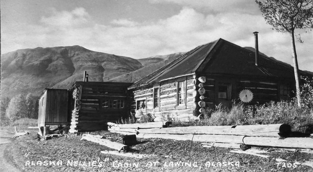
But the end of Roosevelt was nigh: Al Roberts suffered a stroke in 1917. The Roosevelt post office was shut down the following year. Roberts died in 1922, and his widow sold the Roosevelt Road House to Nellie Neal in August 1923.
One month later, Neal married Bill Lawing, and a year after that, “Alaska Nellie” received approval for a new post office, named Lawing. The railway station and siding also became known by that name. With her vibrant personality, Alaska Nellie and her new husband expanded their business and advertised it with zeal. The old Roosevelt identity faded into the past.
Woodrow
This is another Seward-area site located along the railway corridor and named after a president. It was situated roughly west of the lower end of Bear Lake, near Mile 7 of the railway. In 1918, it was listed as a flag stop in a guide published by the Alaska Railroad.
According to Seward historian Colleen Kelly, Grace Johnston Schmidt, granddaughter of John D. Johnston, wrote but never published a family history that said her grandfather, after moving to Alaska from Washington, homesteaded shortly after buying a dairy near Bear Lake in 1904. By October, he had named his new business the Lakeside Dairy.
Johnston later built a lodge for guests near the railway, and in May 1915 he named his homestead “Woodrow Park” after U.S. President Woodrow Wilson. In April 1916, he renovated his lodge to create dining and dancing space, and a month later he began surveying small lots within a 40-acre parcel on his homestead. Thus, a small, mostly recreational community developed.
These days, unincorporated Woodrow is considered more or less a neighborhood within a greater community called Bear Creek, which is named for the stream flowing from the southern end of the lake.