News
Crime & Justice
Education
Elections
Submit a Story Idea
Submit a Press Release
Submit a Photo
Sports
Outdoors & Recreation
Submit Sports Results
Features
Arts & Entertainment
Food & Drink
Contests
Opinion
Homer News Editorial
Letters to the Editor
Point of View
Submit Letter to the Editor
Community
Announcements
Births
Pet of the Week
Submit an Engagement Announcement
Submit a Wedding Announcement
Submit a Birth Announcement
Weather
Obituaries
Place an Obituary
Classifieds
Place An Ad
Legal Notices
Place a Legal Notice
eEdition
Home
Subscriber Center
Subscriber Center
Subscribe
Frequently Asked Questions
Contact Our Subscriber Center
Vacation Hold
Carrier Application
eEdition
Email Newsletters
News
Crime & Justice
Education
Elections
Submit a Story Idea
Submit a Press Release
Submit a Photo
Contests
Sports
Outdoors & Recreation
Submit Sports Results
Features
Arts & Entertainment
Food & Drink
Opinion
Homer News Editorial
Letters to the Editor
Point of View
Submit Letter to the Editor
Community
Announcements
Births
Pet of the Week
Submit an Announcement
Submit a Birth Announcement
Weather
Obituaries
Place an Obituary
Weather
Classifieds
Place a Classified Ad
Legal Notices
Place a Legal Notice
Services
About Us
Contact Us
Submission Forms
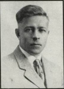
Clark Fair
Features
Winter rescue: Saving the teacher’s life — Part 1
AUTHOR’S NOTE: Many of the “facts” in this century-old story have been buried beneath a stratum of misinformation,…
June 11, 2026
Features
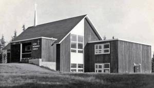
Our Sunday best: Early churches of the central Kenai Peninsula — Part 3
AUTHOR’S NOTE: An earlier version of this story first appeared in May 2013 in the Redoubt Reporter. The…
June 4, 2026
Features
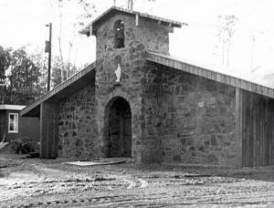
Our Sunday best: Early churches of the central Kenai Peninsula — Part 2
AUTHOR’S NOTE: An earlier version of this story first appeared in May 2013 in the Redoubt Reporter. The…
May 28, 2026
Features
Our Sunday best: Early churches of the central Kenai Peninsula — Part 1
AUTHOR’S NOTE: An earlier version of this story first appeared in May 2013 in the Redoubt Reporter. The…
May 21, 2026
Features
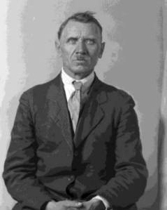
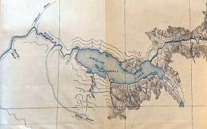
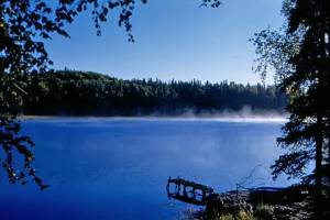
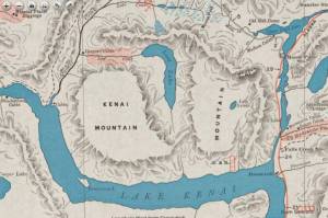
The Killey mystery — Part 2
The name “Killey River”—spelled exactly as it is today—first appeared in print, as far as I can tell,…
May 14, 2026
Features
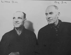
The Killey mystery — Part 1
Think of this article as a crowdsourcing exercise.
May 7, 2026
Features
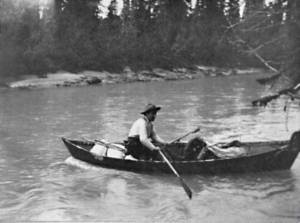
Life-changing moments in the Hawley Sterling story — Part 4
AUTHOR’S NOTE: On Oct. 4, 1918, a young mother named Margaret Sterling left her Nenana home to ride…
April 23, 2026
Features
Life-changing moments in the Hawley Sterling story — Part 3
AUTHOR’S NOTE: On Oct. 4, 1918, a young mother named Margaret Sterling left her Nenana home to ride…
April 16, 2026
Features
Life-changing moments in the Hawley Sterling story — Part 2
AUTHOR’S NOTE: On Oct. 4, 1918, a young mother named Margaret Sterling left her Nenana home to ride…
April 9, 2026
Features
Life-changing moments in the Hawley Sterling story — Part 1
Single moments alter lives. A man leaves for work five minutes late and fails to avoid a serious…
April 2, 2026
Features
‘What’s in a name?’: Reviving a forgotten past — Part 7
AUTHOR’S NOTE: This is the seventh and final chapter in a multi-part series about Kenai Peninsula places and…
March 26, 2026
Features
‘What’s in a name?’: Reviving a forgotten past — Part 6
AUTHOR’S NOTE: This is the sixth in a multi-part series about Kenai Peninsula places and landmarks that once…
March 19, 2026
Features
‘What’s in a name?’: Reviving a forgotten past — Part 5
AUTHOR’S NOTE: This is the fifth in a multi-part series about Kenai Peninsula places and landmarks that once…
March 12, 2026
1
2
3
Next