Homer residents briefly evacuate after quake, tsunami warning
Published 10:30 pm Tuesday, July 21, 2020


Homerites and other coastal Alaskans were roused out of bed last night for an evacuation following a 7.8 magnitude earthquake and subsequent tsunami warning for coastal areas of the state. The warning was canceled within a matter of hours.
The temblor struck just after 10. p.m. Tuesday night, 75 miles south of of Chignik in the Aleutian Chain. The quake was about 8 miles deep, according to the U.S. Tsunami Warning System run by the National Weather Service and the National Oceanic and Atmospheric Administration, though the Alaska Earthquake Center put the quake’s depth at about 14 feet.
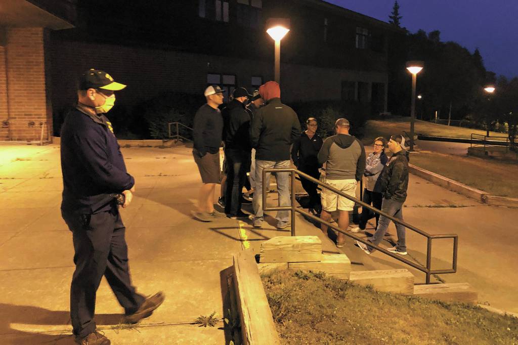
Shortly after the earthquake hit, a tsunami warning was put into effect for coastal areas of Alaska, including Kodiak and Kachemak Bay. People in the communities of Homer, Seldovia, Nanwalek, Port Graham, and the area of Kachemak Bay toward the Fox River Flats were advised to move to higher ground. In Homer, the high school is the designated shelter for people who do not have another place to evacuate to.
Homer High School Principal Douglas Waclawski was on site to direct people at the school.
“We just have to open up, make sure everybody’s safe,” he said.
The school had extra masks and hand sanitizer inside for those who needed them, Waclawski said. If the tsunami had come, those seeking refuge at the school would have stayed overnight, he said.
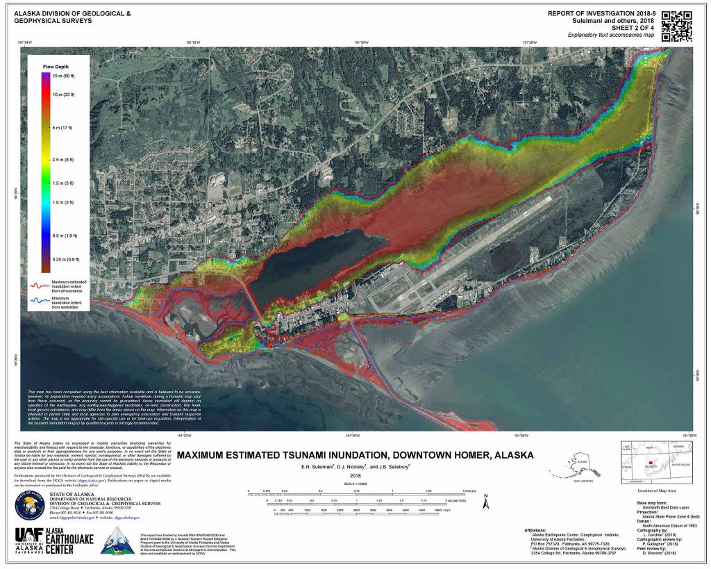
Several dozen vehicles made their way to the high school parking lot, with some occupants remaining with their cars and others taking refuge inside the school, before the warning was lifted. Homer’s inundation zone encompasses the Homer Spit, the Beluga Lake area and part of town located near or slightly above the Homer Bypass road. The general rule of thumb is to get above Pioneer Avenue when in search of high ground.
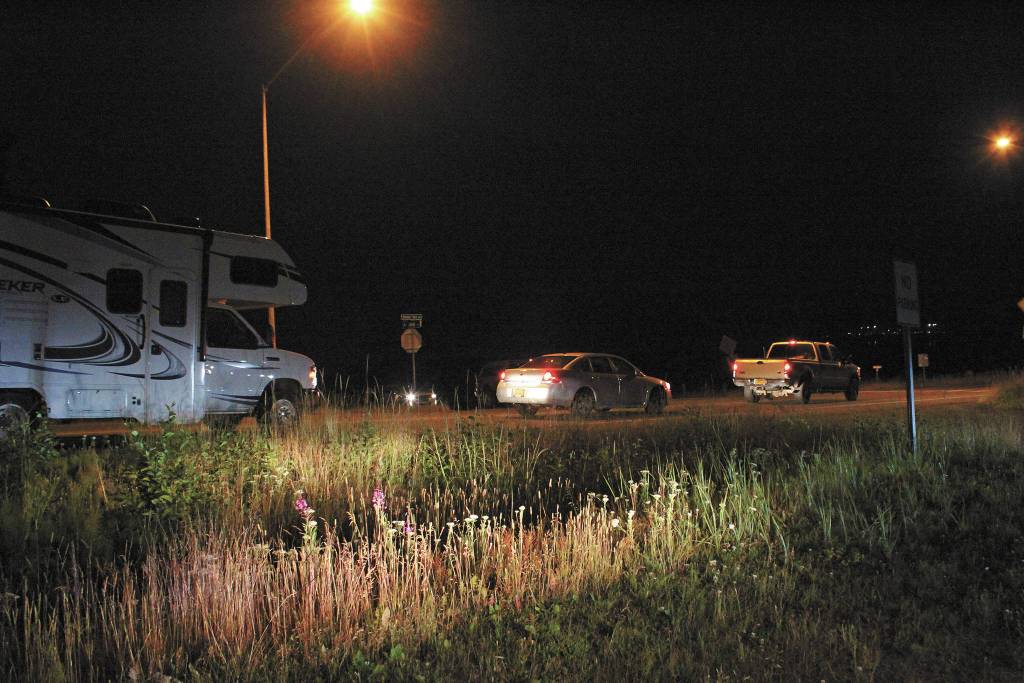
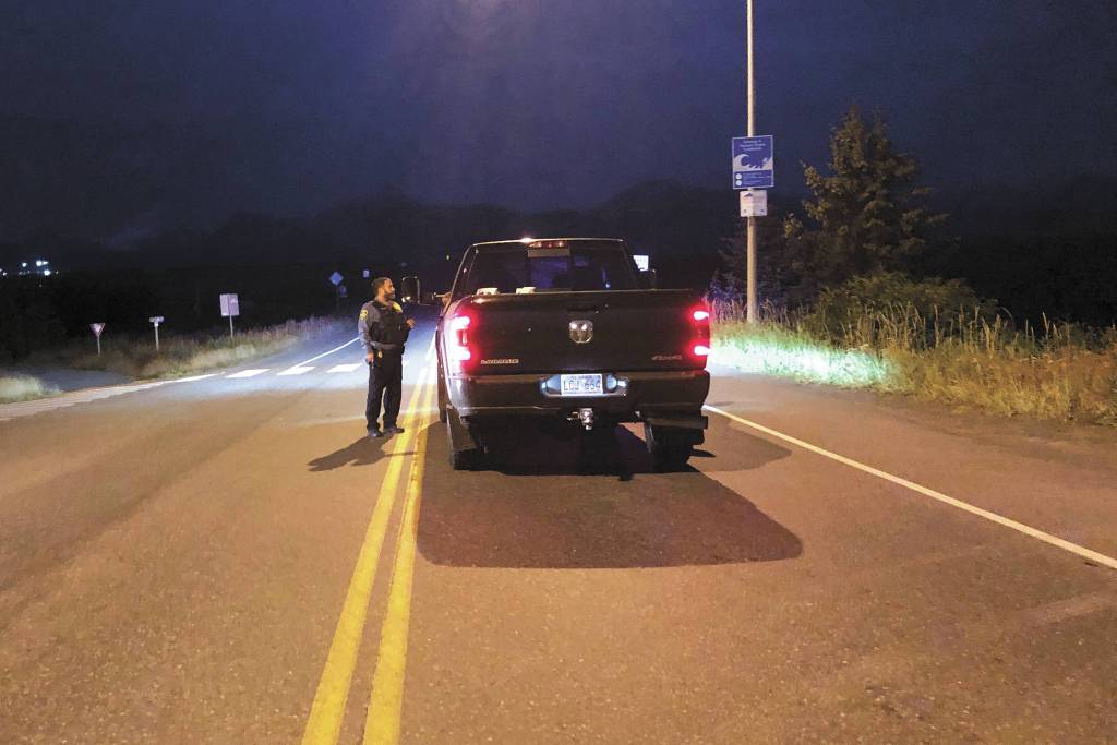
Members of the Homer Police Department and Homer Volunteer Fire Department helped evacuate campers, tourists and others from the Homer Spit, and advised residents below Homer’s inundation zone to move to higher ground.
Seward and the Resurrection Bay area were put under a tsunami advisory, which is lower than a warning level. A tsunami warning means that a tsunami is already happening or is possible.
The warning was lifted just after midnight on Wednesday, and residents who had evacuated were allowed to return home. That was easier for some than for others, like Chad Grasmick and James Compton, who had only just arrived from the Matanuska-Susitna Valley when they got the tsunami warning alerts on their phones.
The pair were on their way to get Compton onto the state ferry Tustumena to connect him with a commercial fishing job. The earthquake and resulting tsunami warning threw a wrench into those plans.
“It’s out in open water,” Grasmick said of the ferry while the two parked at the top of the Homer Spit. “It left as soon as the warning went off.”
From the perspective of the Homer Police Department, the evacuation went well, said Chief Mark Robl. Officers were able to evacuate the people out on the Spit almost entirely, he wrote in an email.
“We had a few people that refused to leave,” Robl said. “People self-evacuated very well. We always learn a few things when these events happen and last night was no exception.”
According to the U.S. Tsunami Warning System, a tsunami was generated by the earthquake, but the warning was lifted because it was found that the tsunami did not pose a threat to the area.
Rachel Tussey, deputy city clerk and public information officer, said things also went pretty well from the city’s perspective. One thing city staff did notice, however, was that some residents seemed to be confused as to whether they needed to evacuate or not, Tussey said.
Most people understand what Tussey called Homer’s “low-lying levels,” but she said some weren’t sure exactly where the line is that denotes 50 feet of elevation. Anyone located below that 50-foot mark was advised to move to higher ground. This is a good opportunity for people to take the time to learn the boundaries of Homer’s inundation zone, and to find out whether they live in the low-level areas that are subject to evacuation, Tussey said.
“We greatly appreciate the community’s response to this tsunami warning,” she wrote in an email. “It may seem like a lot of disruption all for nothing, but as Alaskans we know how often earthquakes hit, and we know that big ones do happen. That is why it’s imperative to be prepared: learn ahead of time where Homer’s tsunami inundations zones are and where to go during a tsunami evacuation. Thanks to the angled entrance of Kachemak Bay from (Cook Inlet), it is less likely we’d get a direct wave towards Homer, but earthquakes can trigger an underwater landslide in Kachemak Bay, giving you minutes rather than hours to reach safety.”
A map of the specific zone subject to evacuation in Homer is linked on the city’s website under the emergency information section at cityofhomer-ak.gov/emergency-information.
Homer Volunteer Fire Department Chief Mark Kirko is out of town, but says he was kept abreast of the situation from afar. When the tsunami warning was enacted, the Homer Incident Management Team was assembled at the fire station, Kirko said in an email, where its members coordinated the evacuation of the Spit and other low-lying areas of Homer.
“From there they were able to monitor the live updates from the Alaska Tsunami Warning Center and prepare for a potential wave event,” Kirko wrote.
Kirko said he was kept up to speed by Assistant Chief Joe Sallee, who serves as the deputy incident commander when Kirko is gone.
“From what I understand, Spit evacuation went well and most people were evacuated in an orderly and expeditious manner and there were no reported injuries to citizens or responders that I am aware of during the evacuation process,” Kirko wrote.
Kirko echoed Robl’s sentiment that these events are learning opportunities for the city’s various emergency response agencies.
“I would like to recognize the visitors and residents on the spit that reacted quickly and safely to the tsunami warning,” Kirko wrote. “Though we did not see an increase in tidal surge, had there been a significant wave event their decision for quick action quite possibly would have saved many lives.”
The earthquake itself was felt as far north as Fairbanks, and from as far away as Victoria and Vancouver in British Columbia, according to the Alaska Earthquake Center.
“Preliminary moment tensor solutions suggest that this event had a thrust mechanism typical of a subduction zone interface event,” the center’s website reads.
Reach Megan Pacer at mpacer@homernews.com.