‘What’s in a name?’: Reviving a forgotten past — Part 5
Published 1:30 am Thursday, March 12, 2026


AUTHOR’S NOTE: This is the fifth in a multi-part series about Kenai Peninsula places and landmarks that once had different names. Previously, the series has discussed Sterling, Soldotna, Cooper Landing and Tern Lake.
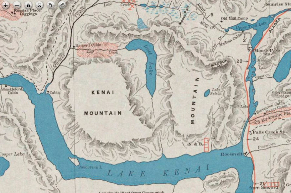
The multi-talented physician and surgeon, Dr. David H. Sleem, was still a resident of Seward in 1910 when he published what is arguably one of the most famous maps in the U.S. history of Alaska—his hand-drawn “Map of Kenai Mining District and Moose Pass Regions, Kenai Precinct, Alaska.”
The map, one of at least four created in the last years before his death, was elegantly crafted, detailed in its delineation of cabins, placer mines, ore-bearing lodes, trails and wagon roads, in addition to being geographically sound enough to allow it to be a useful travel and exploration tool for several decades.
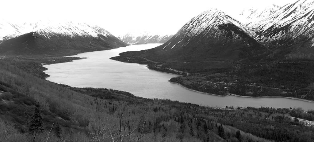
Despite its many successes, the map was not perfect. For instance, those who view the map today and are familiar with the area may be startled to see that Crescent Lake (north of the middle portion of Kenai Lake) bends in the wrong direction. The lake, as seen on modern maps, arcs to the left from its Crescent Creek outlet to its headwaters near Carter Lake. On the Sleem map, it arcs to the right.
To be fair, in those roadless days of the central Kenai Peninsula more than a century ago, it would have been difficult to “ground truth” all of the trails and streams, lakes and peaks that Dr. Sleem depicted on his map. He almost certainly relied on prior maps and on information from other sources, so some imperfections are understandable.
Modern viewers, however, may be further confused by the names that Sleem applied to this body of water and its outlet: Lost Lake and Lost Creek.
At the time the map was made, Sleem was correct.
According to Donald J. Orth, in his Dictionary of Alaska Place Names, the current names were applied by the U.S. Geological Survey in 1952 “because of the shape of the lake.” It is possible, too—although unmentioned by Orth—that the change from “Lost” to “Crescent” had something to do with eliminating possible confusion with the Lost Lake and Lost Creek north of Seward.
Other Kenai Peninsula lakes and streams have shifted their identities over the years. Here are a number of examples.
Upper and Lower Alcatraz Lakes
These two lakes, just off Skilak Lake Loop Road in the Kenai National Wildlife Refuge, were named originally by employees of the Alaska Road Commission in about 1947. The prison on Alcatraz Island, off the California coast, was known as “The Rock,” and A.R.C. crews, after blasting and removing huge quantities of rock from the path of what would, for several years, be a section of the Sterling Highway, decided to name the lakes in tribute to their efforts.
During a large lake-naming effort in about 1963, refuge personnel decided to change the Alcatraz lakes to Upper and Lower Ohmer lakes in honor of Earl Nicholas Ohmer, former chairman of the Territorial Alaska Game Commission.
It was common in those days to name landforms and waters after government officials, especially those considered important to a particular area. Ohmer died in 1955, and the name change was made permanent in 1965.
Rat Creek
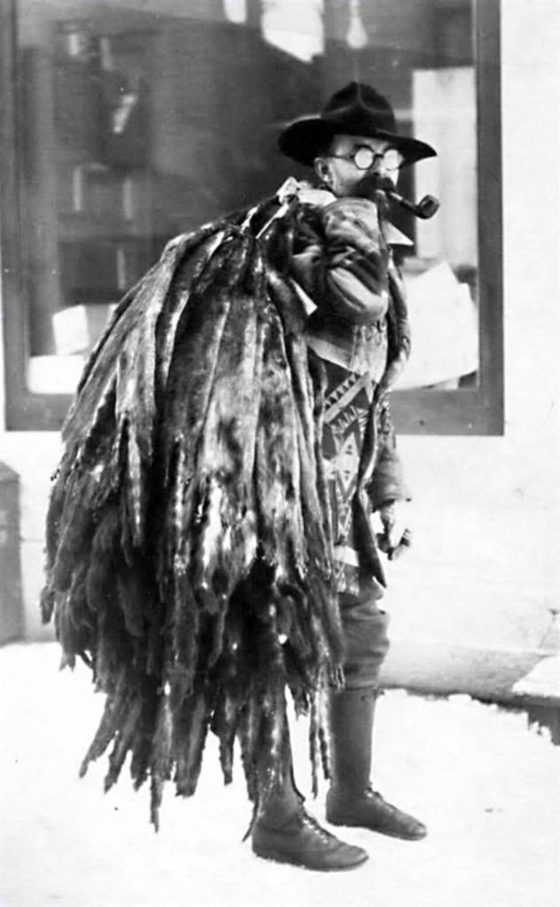
King David Thurman was prospecting on the Kenai Peninsula by at least the early 1900s. Eventually, he began living primarily on Bean Creek, by Cooper Landing, and hiking into what is now a portion of the Resurrection Pass Trail to mine for gold. It is uncertain whether he applied the name “Rat Creek” to the stream along which he focused his mining efforts, but he clearly referred to the creek by that name in his mining-claim documentation with the Seward Recording Office in 1912.
Rat Creek was a tributary of the Chickaloon River, and by the summer of 1914 it appears that King Thurman had located another promising mine site downstream from his legal claims on the creek. At this new site, the location of which he kept secret, he constructed a small cabin and set to work.
His body, ravaged by a brown bear many months earlier, was discovered inside this cabin in early 1915. After an investigation, the cabin was burned to the ground with Thurman’s remains inside. By at least 1944, the creek had been renamed Thurman Creek in honor of the miner.
Second and Lower Kenai Lakes
The documentation on the name changes for these lakes is somewhat thin. According to Orth, what we know now as Kenai Lake was once called Second Lake—perhaps because it was the second lake that one reached when traveling up the Kenai River from Cook Inlet.
Some early explorers and miners also referred to it as Lake Long, given its 22-mile length from the Snow River mouth to the Kenai River outlet. But the U.S. Geological Survey reported the name “Kenai Lake” as early as 1898. Likely, the name varied early on until more reliable maps, such as Sleem’s in 1910, became popular. Sleem labeled this body of water as “Lake Kenai.”
For those who traveled downstream from Kenai Lake, however, Skilak Lake was the second lake that travelers encountered. Perhaps for that reason, it was referred to by some as Lower Kenai Lake. “Skilak” itself is a Dena’ina name, reported as early as 1840 by the Russian scientist Igor Wosnesenski.
Porcupine Creek
In the early 1900s, two streams named Porcupine Creek flowed into Kenai Lake. Today, one of those streams has a new name, while the other is rarely labeled on maps.
The unlabeled stream, across Kenai Lake from Porcupine Island, is about two miles long and flows northeast into the lake. The other Porcupine Creek—now Primrose Creek—flows into the head of the lake near the Primrose Campground.
In late 1911, gold miner Edward Everett Schoonover located two hard-rock quartz-lode claims on Porcupine Creek at an elevation of about 1,000 feet. He named his claims Primrose 1 and Primrose 2, according to Mary J. Barry’s history of mining on the Kenai Peninsula. A mine soon cranked into operation and—during a flurry of share-selling and stock-creation—numerous small veins of gold were probed and extracted.
An assessment of gold-producing sites on the Kenai Peninsula in late 1912 revealed that the Primrose Mine had extracted $8,000 worth. Afterward, the mine continued to change hands and produce gold, while occasionally running into difficulty. In the meantime, recreational interest in the drainage and in the nearby Lost Lake area prompted trail building. In 1960, the U.S. Forest Service renamed the stream because of its connection to the mine.
The third edition of the hiking book, “55 Ways to the Wilderness,” published in June 1985, was the first to make the traverse official between the Primrose Trail and Lost Lake Trail. Prior to that, some route-finding was necessary, as was wading cold, knee-deep Lost Creek.
NEXT TIME: A MELANGE OF OTHER CHANGES