
In the past 10 years since fat bikes have become popular for riding on beaches and snow in Alaska, people have regularly ridden them from Anchor Point to Homer or into the snowy backcountry of the Caribou Hills. On Saturday, Homer couple Kim McNett and Bjørn Olson finished taking their fat bikes where no one has ever ridden before, about 450 miles in a 24-day trip from Point Hope to Utqiagvik, much of it on Arctic beaches.
On what Olson calls The Roof of the Arctic trip, they used pack rafts to make river and bay crossings, but the bikes with wide tires that can ride on sand and softer snow proved perfect for traveling the barrier island beaches of the northwest Arctic coast.
“It was by far the most incredible trip I’ve done,” Olson said on Monday after returning to Homer. “This one had so many elements wrapped together — one of them this uncertainty it might not be possible.”
Olson and McNett have ridden fat bikes throughout Alaska in winter and summer, including trips along the Iditarod Trail, from Anchorage to Kotzebue, and Nome to Kivalina. They also have circumnavigated the Kenai Peninsula by fat bike and pack raft. Olson said except for a gap between Kivalina and Point Thompson, he and McNett have now traveled by human power from Anchorage to Utqiagvik, formerly known as Barrow.
Olson and McNett started their trip on June 19 in Point Hope, the westernmost tip of the Northern Arctic. Two other Homer adventurers, Alayne Tetor and Daniel Countiss, joined them on an early part of the trip from Point Hope to Point Lay. Tetor planned to go as far as Point Lay, about halfway between Point Hope and Utqiagvik. Countiss got sick near Point Lay and had to drop out of the expedition there.
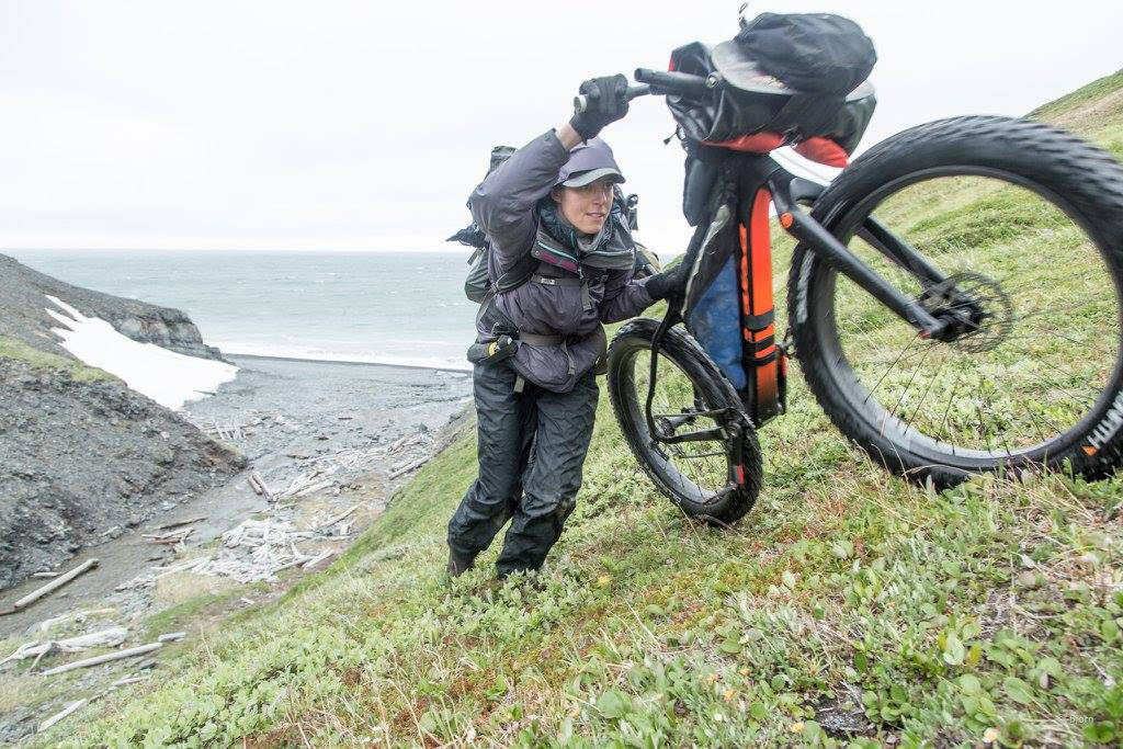
Salsa Bikes sponsored Olson and McNett, and Alpacka Rafts provided them a prototype pack raft with a lighter material and longer design. They have perfected a travel technique where they can carry a fat bike on the bow of the inflatable rafts. On some legs they had to push their fat bikes up and over hills or through rough terrain like tussocks. The trip involved riding, pushing and paddling.
“We did all those things. Really, the lion’s share was by far a cycling trek, which is so awesome,” Olson said.
From Point Hope to Point Barrow, long, thin barrier islands stretch along the Chukchi Sea coast. For millennia, that has been a superhighway for Inupiaq people traveling by boat, dog team and later, snowmachine, four-wheelers and powered boats. Frozen ice and wind packed snow can make the run easy in winter, but in summer open water between the islands and at stream crossings meant getting out the raft. Some river or stream crossings were short, but others involved tedious unpacking and inflating rafts and loading up gear to cross a creek that might be a stone’s throw to cross but too deep to wade.
On previous trips, Olson said they might have ridden 60 percent of the time. On this trip, Olson said about 90 percent of the time they biked. In the first leg of the trip from Point Hope to Wevok at Cape Lisburne, high cliffs meant rafting. Olson said they paddled for most of a day about 25 miles north of Point Hope before the wind got too strong.
“And then the wind just nailed us — consistent hurricane for four days,” he said.
In that area, they rode over the Lisburne Hills, a mix of smooth and tough going on tussocks — the curse of the Arctic overland traveler. Like grassy basketballs, they dot the tundra. When it became hard to ride on the beach because of drifts, they pushed up and rode down creek divides, “doing these big up-and-overs with minimal pushing, mostly riding,” he said.
The journey was a first for Tetor both in that it was the largest biking trip she had undertaken, and because it was it was a trip no one had made by bike and pack raft before.
“I had never done a trip that had never been done before,” she said. “Anything that I’ve done before is like where you can look at somebody else’s trip report … I think that added to it just this level of adventure that I had never experienced before.”
One unexpected outcome of the trip was the areas of the beach the group had planned on biking weren’t passable that way due to the massive snowdrifts, so paddling became a more prominent mode of travel than Tetor had anticipated.
None of the challenges the group faced on the way to Point Lay were of the catastrophic variety, Tetor said — it was more the overarching sense that they were so far removed from help, should they need it, that was a challenge for her.
That same remote quality of the trip was also one of its greatest rewards, however. Tetor remarked on how untouched the landscape was along their travel route, compared to the fishing and container ship debris she’s used to seeing on beaches.
“It was so pure,” she said. “We barely saw any garbage.”
Part of Alaskans Know Climate Change, an effort to increase awareness of climate change in Alaska, the Roof of the Arctic group also did some citizen science. Using the Shorezone database of waypoints from the early 2000s along the Arctic coast recorded in their GPS, they resurveyed sites — “reoccupying,” in surveying terms.
“Several of them we couldn’t reoccupy because they’re in the sea,” Olson said. “Most of the places, there is massive evidence of erosion.”
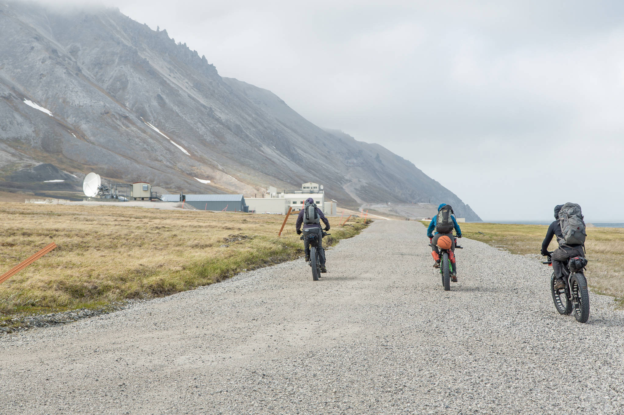
Near Cape Lisburne they took a side trip to Wevok, a Cold War era early-warning radar base. As a back-up, they used an InReach communications device made by Garmin. That ran out of power near Wevok and the crew there let them recharge their batteries.
The InReach allowed them to send brief messages about their status and position locates and also an emergency alert. Seldovia friend Brentwood “Hig” Higman was their ground control for the expedition and monitored the InReach broadcasts.
“It’s the ultimate ‘if the s—- hits the fan,’” Olson said. “What’s much better about it is if somebody broke a leg and you needed an evacuation, you can email somebody.”
The fat bikers carried bear spray for protection, and Olson had a .44 caliber handgun. On the coastal beaches, the biggest potential danger came from brown or polar bears feasting on whale or other animal carcasses.
“That was the one great piece of bear advice we had: if you see a carcass, swing wide,” Olson said.
Olson said they had one brown bear encounter that “went as perfect as you could possibly imagine.”
“We put our bikes down. We stood side by side. It got close enough to smell us … It just ran,” he said.
They camped in floorless, lightweight nylon, pyramid shaped tents held up by pack raft paddles. Mosquito netting sewn around the bottom and tucked up inside the tent offered ventilation. With so much wind, mosquitoes rarely became a problem. On still days, though, mosquitoes would fly behind them in their tailwind.
“There would be just a little eddy of them. When you’re not biking, they’re not bothering you. When you stop, boom,” he said.
For bear safety, they used an electric fence strung around them on tent stakes and powered by AA batteries. On a prior trip in Katmai National Park, Olson used the electric fence, but said he had his doubts on if it would work on an 800-pound coastal brown bear.
“One morning I heard ‘whoof,’ and there was this huge brown bear running from camp,” he said.
Friends sent flat-rate boxes of food up to villages along the way. McNett and Olson got stuck in Wainwright for three days waiting for someone to open up the post office and get their package. They usually ate multigrain cereal for breakfast, snacked on energy bars, cheese and jerky during the day, and made a big dinner with a carbohydrate base like polenta or pasta. They cooked on open fires using driftwood on the beach, and only once couldn’t find firewood.
Villages also gave them Native food. At Point Lay they arrived just in time for the spring whaling festival, Nalukataq, and ate boiled muktuk, “soft and buttery,” Olson said. They also ate plants like beach greens.
Everyone along the coast, even in the big town of Utqiagvik, knew of them and their travels, courtesy of the Inupiaq telegraph — the sharing of news from village to village. Whenever they ran into other travelers, they’d stop and talk. One time some caribou hunters gave them a slice of liver. At the whaling festival they had a great reception.
“My typical thing was ‘they think we’re wing nuts, stupid white people.’ This had a different feel,” Olson said of the trip’s reaction from Natives. “They were interested in the bikes. They were so supportive. They gave us their vote of confidence, which made us feel great.”
Olson said the scale of the terrain and the richness of the wildlife impressed him.
“I’ve seen a lot of beluga whales before, but nothing like that — pods of 100,” he said. “More than anything else was the cultural aspect of it. To be made to feel welcome and feeling blessed with the Native experience was really gratifying,” he said.
Many Native Alaskans have visited elsewhere in Alaska, including Homer, but the inverse isn’t true, Olson said.
“I feel sometimes a little guilty because I had these great experiences,” he said. “Most Alaskans on the road system have no idea of the richness of the indigenous cultures in Alaska.”
After experiencing such a big adventure, Tetor doesn’t plan to slow down. In fact, she struck out for a hiking and pack rafting trip through the Alaska Range with her boyfriend a mere two days after her stint on the Roof of the Arctic.
It was a bit of a struggle since she was starting out tired from the first trip, but Tetor said the Roof of the Arctic gave her a big confidence boost to be able to tackle similar journeys in the future.
“I like the idea of riding the bike more,” she said. “I think it’s a lot easier on the joints when you’re traveling long distances.”
Originally, McNett and Olson had planned to continue on this summer to Kaktovik. When they got talking to people, no one gave them a thumbs up, Olson said. The distance between barrier islands gets wider from Point Barrow, and riding inland through North Slope wetlands would be a mosquito hell. They’re rethinking their approach and might try a late winter trip next year.
For more on the trip, visit mjolnirofbjorn.com/journal/2017/6/16/roof-of-alaska.
Michael Armstrong can be reached at michael.armstrong@homernews.com. Megan Pacer can be reached at megan.pacer@homernews.com.
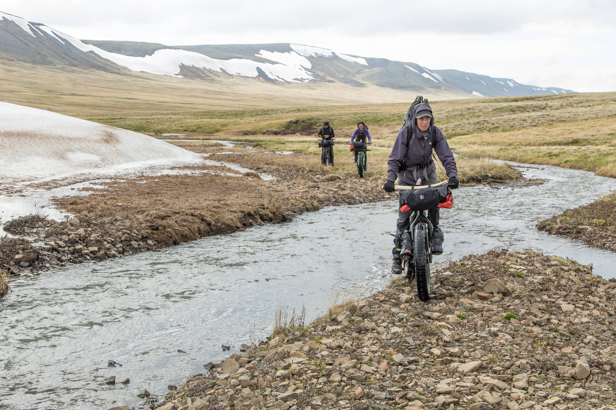
Kim McNett leads Alayne Tetor and Daniel Countiss along a creek valley. (Photo courtesy Bjørn Olson)
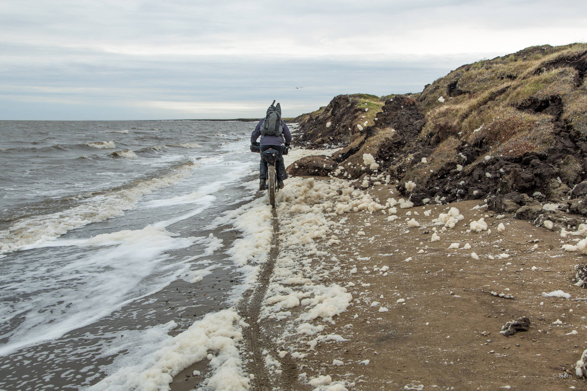
Some sections of beach were so narrow the fat bikers had to skirt the surf and sea foam. (Photo courtesy Bjørn Olson)
Kim McNett leads Alayne Tetor and Daniel Countiss out of Point Hope at the start of their trip. (Photo courtesy Bjørn Olson)
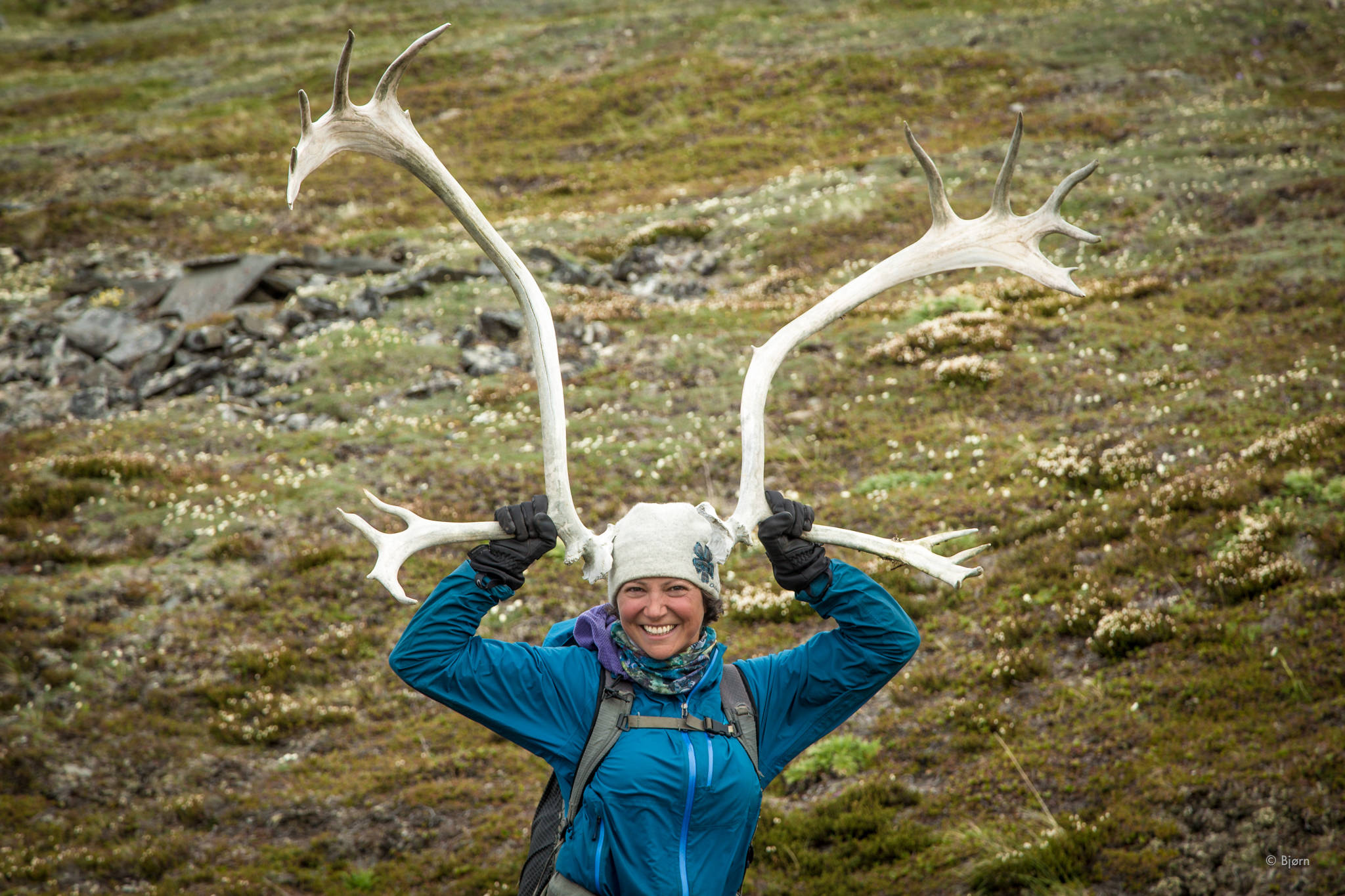
Alayne Tetor holds up a pair of caribou antlers. (Photo courtesy Bjørn Olson)
The Roof of the Arctic group bikes along the beach before heading inland to the Lisburne Hills. They had to backtrack after setting up their camp earlier. (Photo courtesy Bjørn Olson)
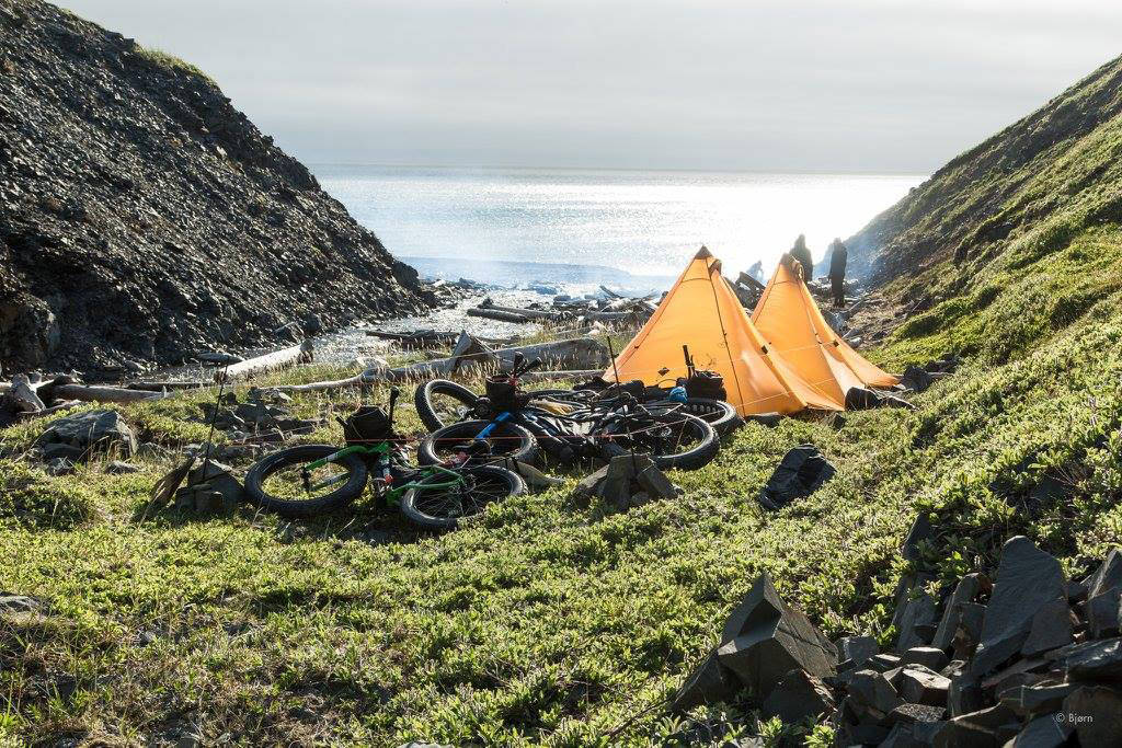
The group’s campsite along the coast. They used floorless, lightweight nylon tents with mosquito netting around the bottom. (Photo courtesy Bjørn Olson)
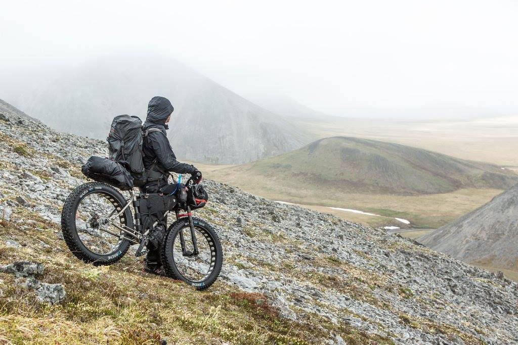
Daniel Countiss pauses before heading down a hill. (Photo courtesy Bjørn Olson)
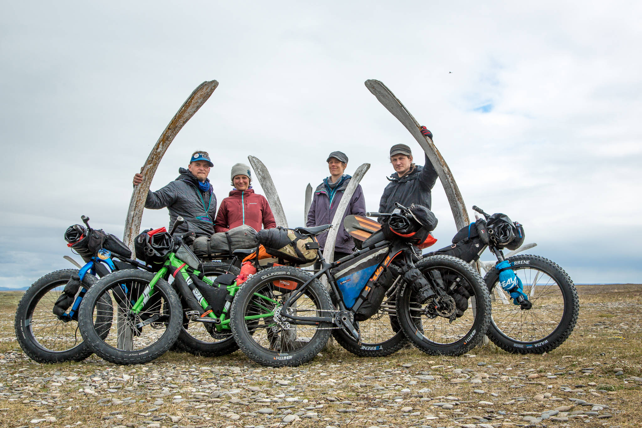
The Roof of the Arctic group pose for a photo next to whale jaws. From left to right are Bjørn Olson, Alayne Tetor, Kim McNett and Daniel Countiss. (Photo courtesy Bjørn Olson)
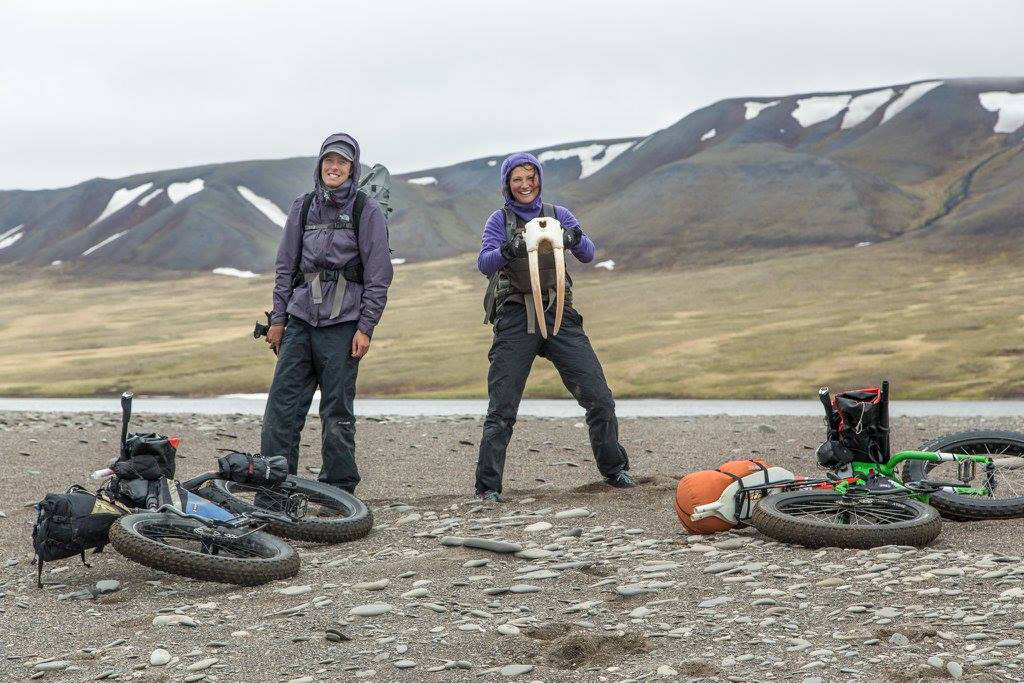
Alayne Tetor, right, holds a walrus skull she found on the beach on the way to Point Lay. Kim McNett is at left. (Photo courtesy Bjørn Olson)
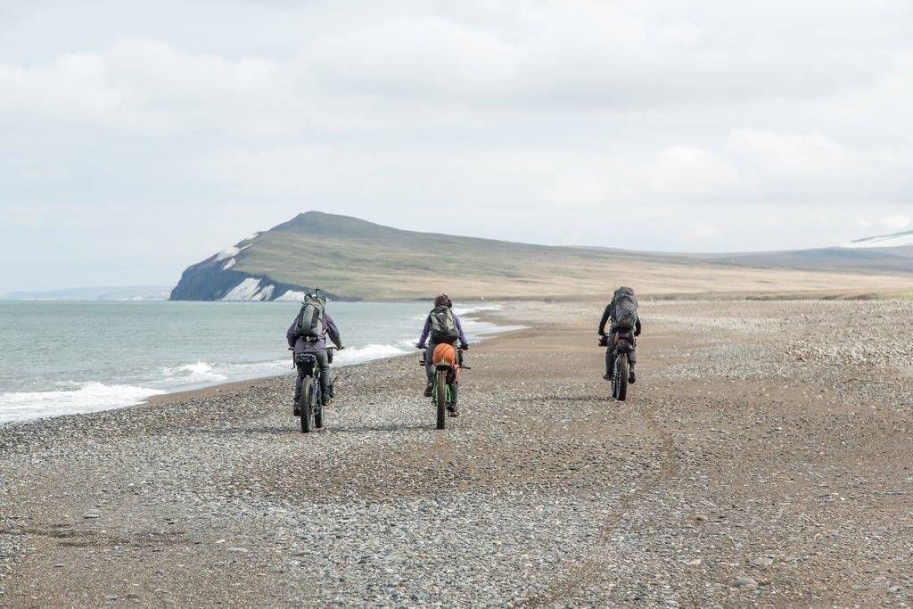
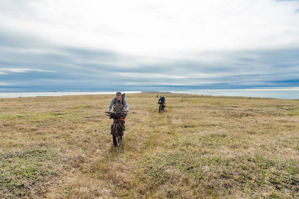
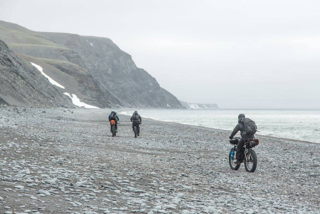
The group heads north on a firm beach — perfect riding conditions for fat bikes. (Photo courtesy Bjørn Olson)
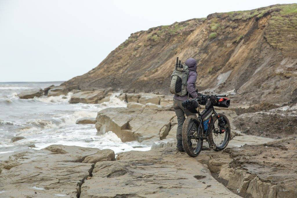
Kim McNett looks at a stretch of beach that has run out. (Photo courtesy Bjørn Olson)
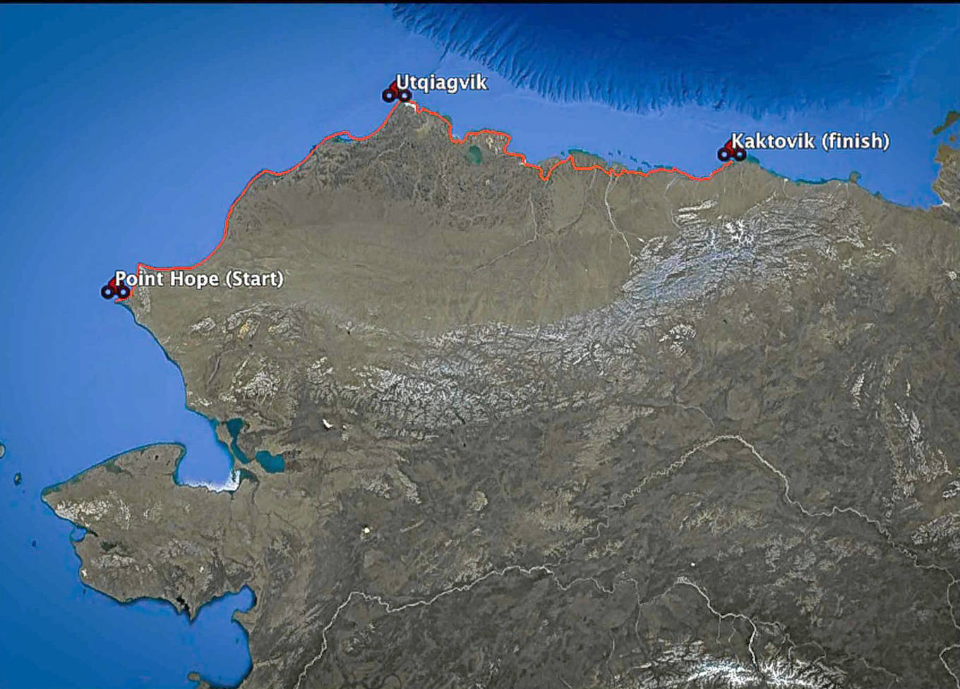
This map from the Roof of the Arctic website shows the planned route of the expedition. Kim McNett and Bjørn Olson biked from Point Hope to Utqiagvik this summer, and plan to finish the route to Kaktovik next year. (Photo courtesy Bjørn Olson)
Kim McNett pushes her fat bike up a hill on the up-and-over portion in the Lisburne Hills. (Photo courtesy Bjørn Olson)
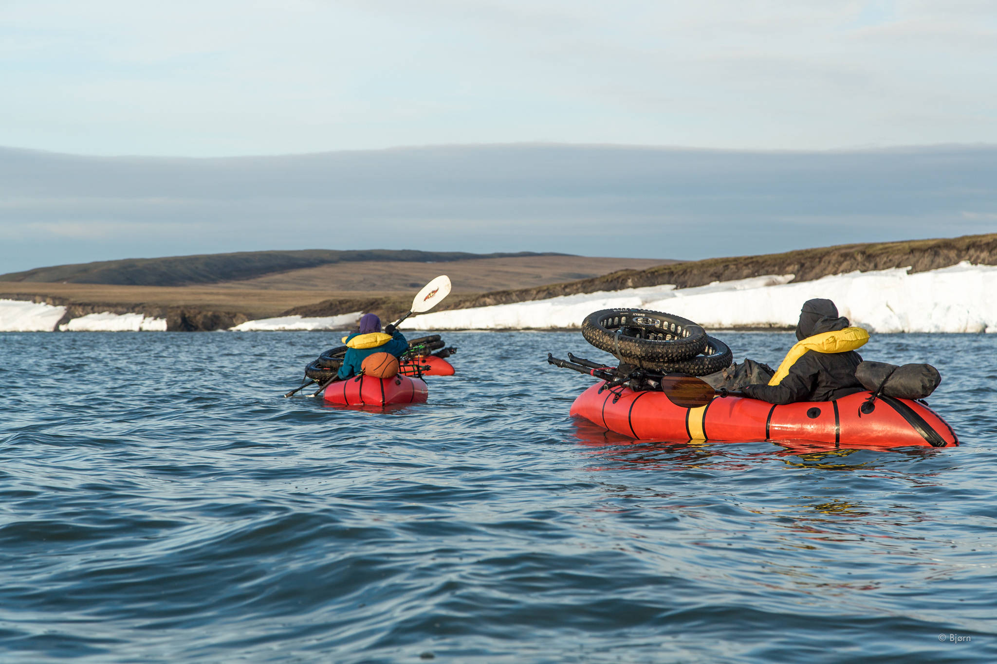
Along sectins of the coast where snow drifts clogged the beach, the Roof of the Arctic group had to paddle in pack rafts around the barriers. (Photo courtesy Bjørn Olson)
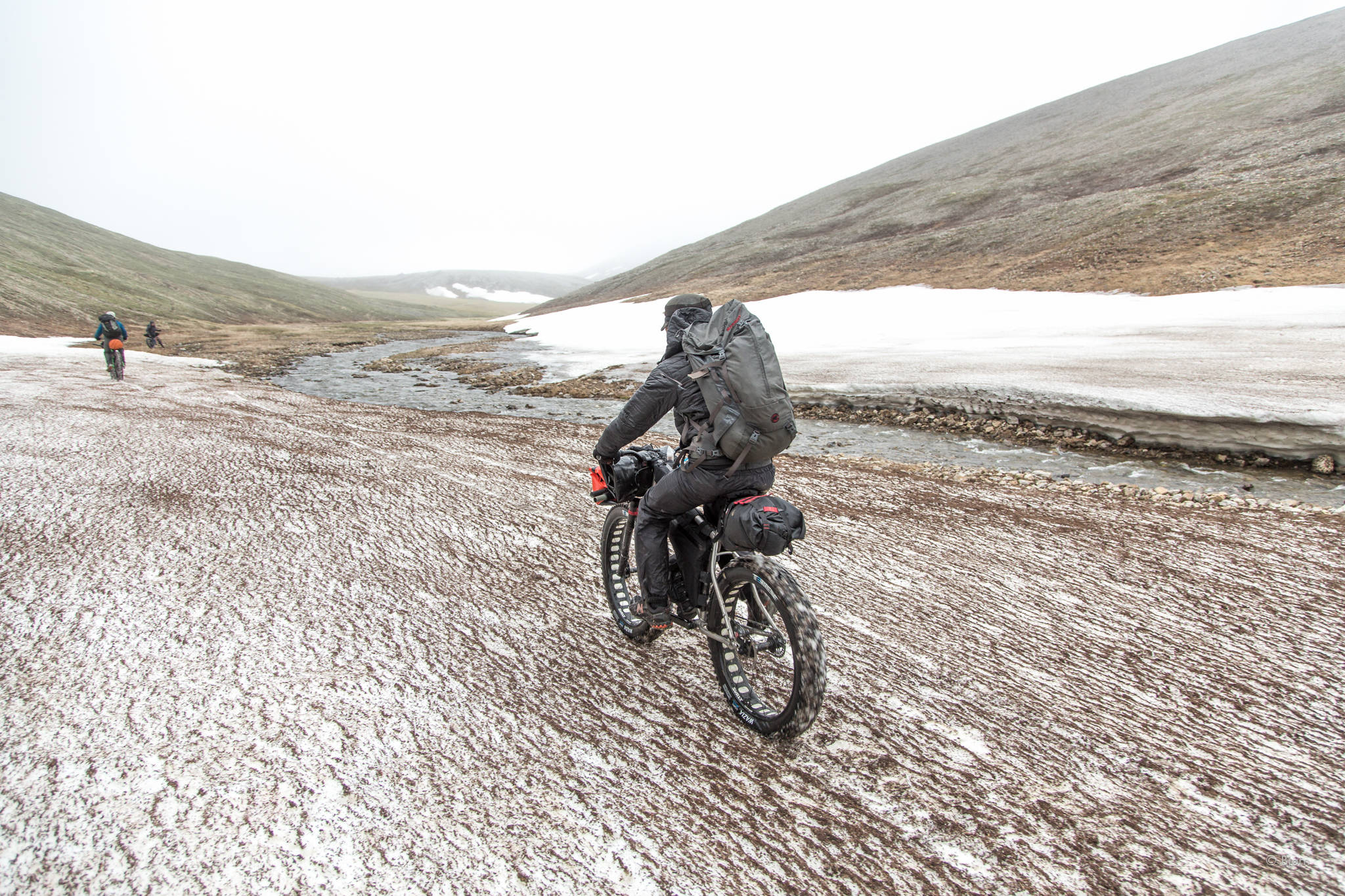
The group heads rides along snow in a creek valley. (Photo courtesy Bjørn Olson)
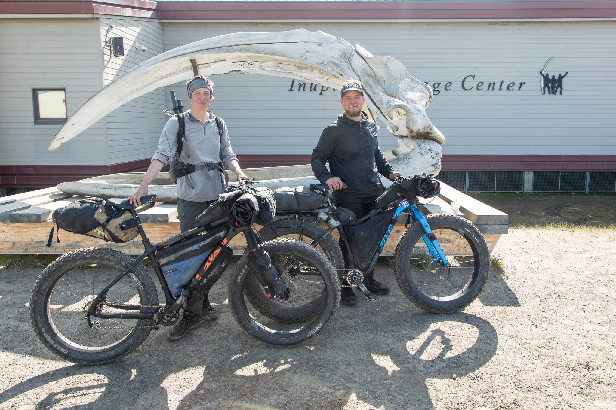
Kim McNett, left, and Bjørn Olson, right, stand with their Salsa fat bikes by a bowhead skull in Utqiagvik (formerly known as Barrow). (Photo courtesy Bjørn Olson)
