Crews get dozer line around North Fork Fire; Diamond Ridge, North Fork areas still on ‘Ready’ alert
Published 1:30 am Monday, August 19, 2019


Update at 1:40 p.m.:
A link to the Kenai Peninsula Borough Office of Emergency Management website with information on the Level-1 alert status has been added here: http://kpboem.blogspot.com/2019/08/081919-north-fork-fire-diamond-ridge.html . Information also is available here to sign up for borough emergency alerts: https://alerts.kpb.us/ .
Update at 11 a.m. Tuesday, Aug. 20:
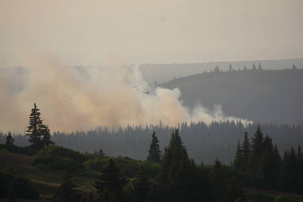
A dozer line has been put in to encircle the North Fork Fire, now estimated to be about 60 acres. The Zigzag Hotshot crew from Oregon is reporting today to help the Chugachmiut Yukon Wildland Fire Crew, the initial attack crew from Palmer, put in hose lines on the dozer line. Fire officials aren’t calling the fire contained yet, however.
“We’re in a good place with the dozer line and getting hoses laid in place,” said Sam Harrel, a public information officer with the Alaska Division of Forestry.
Harrel said there was some activity on Monday night but nothing that challenged the dozer line. There was no reported growth of the fire on Monday.
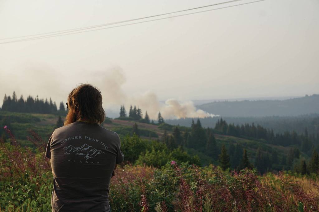
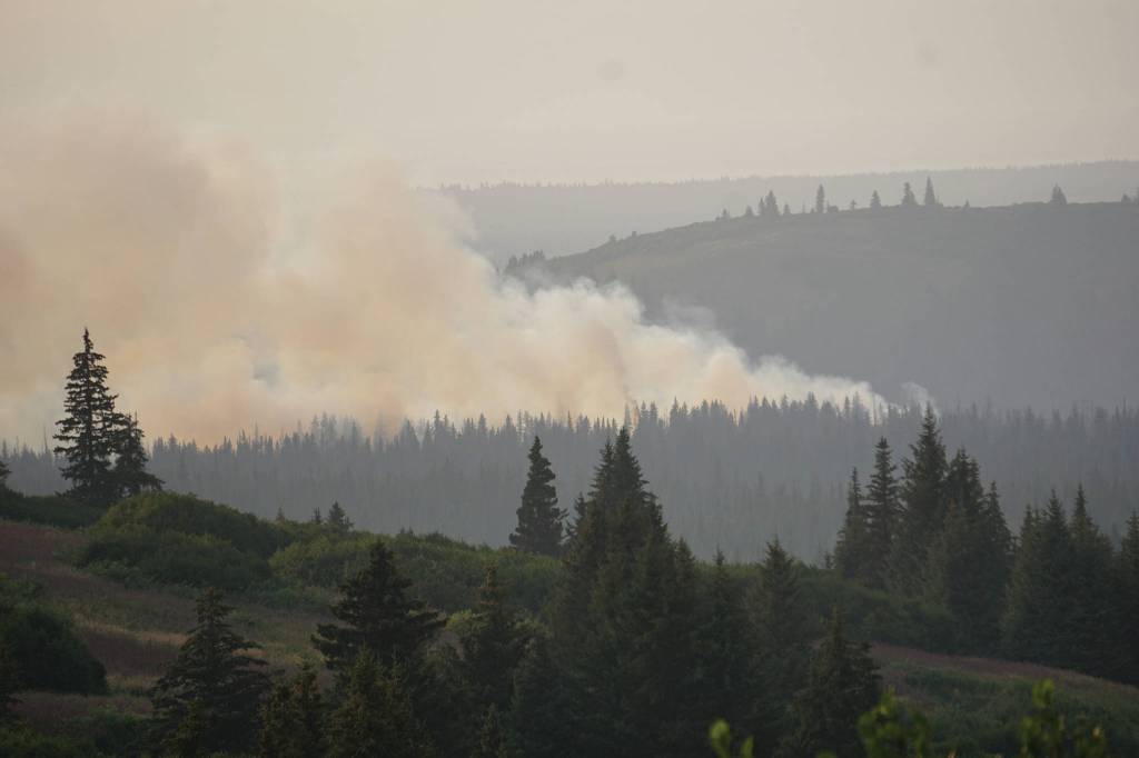
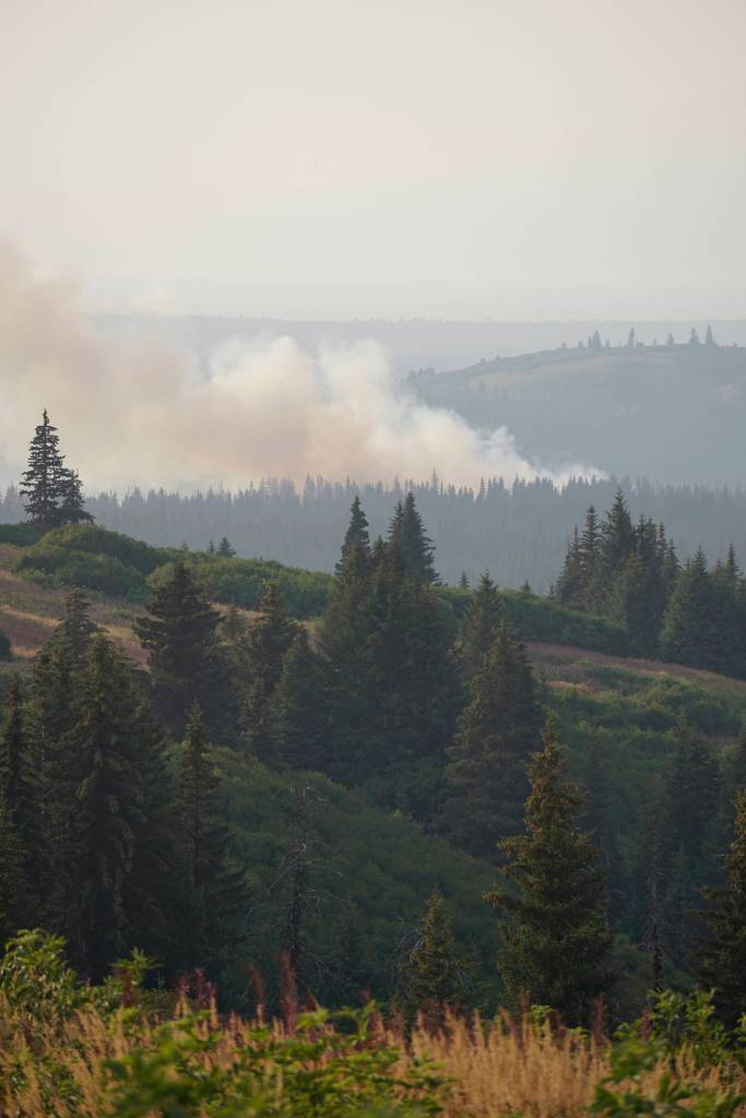
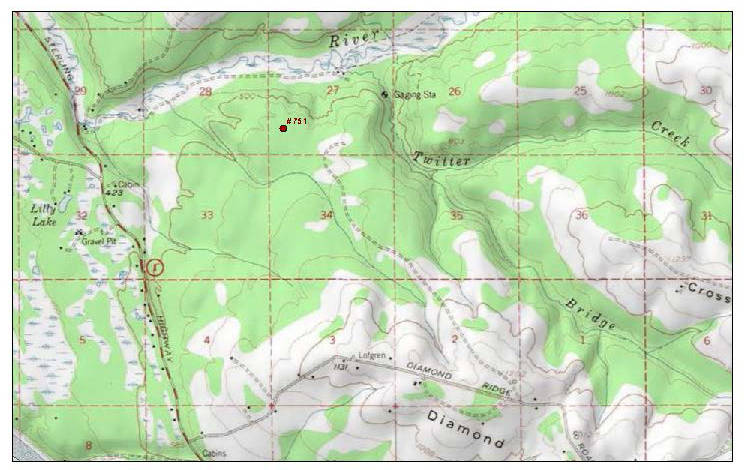
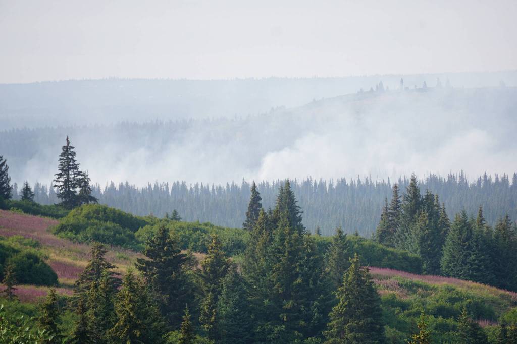
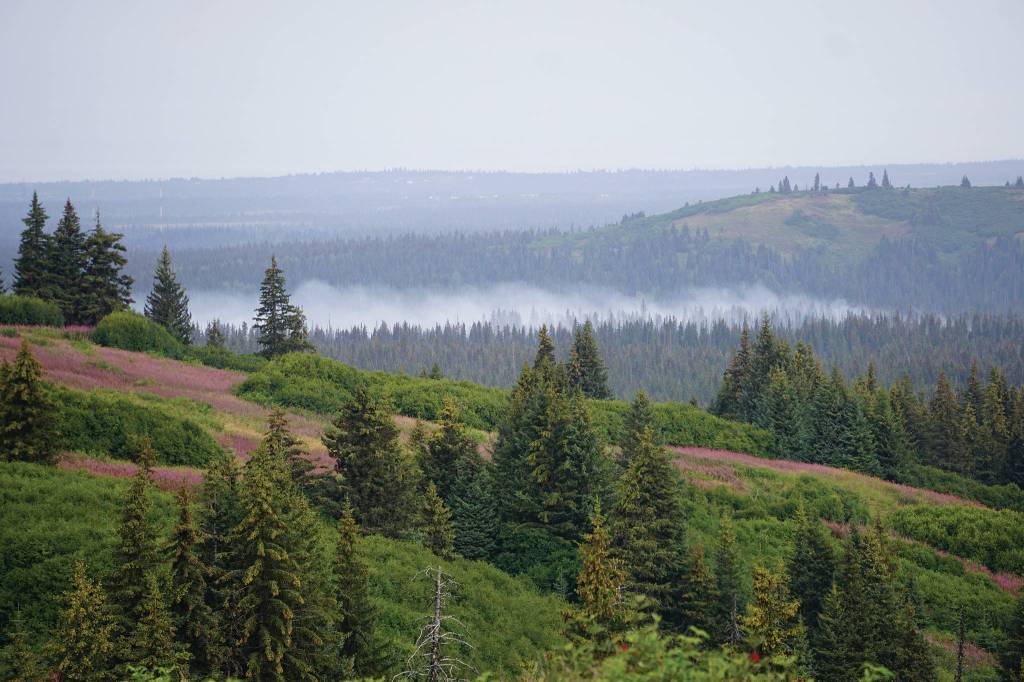
As seen from Diamond Ridge Road about 8:45 a.m. Tuesday, the fire appeared reduced in size, with some white smoke blowing to the southwest and away from the south North Fork Road area.
The south North Fork Road and Diamond Ridge Road neighborhoods remain under a Level-1 or “Ready” status.
“Quite honestly, we live here in Alaska in a fire-prone place and it’s warm and dry,” Harrel said. “We all need to be ready. Think about your plans, what you need to do. … We’re asking people in that area to be ready should it be elevated to ‘set,’ but it’s looking real good with that dozer line.”
Update at 6:30 p.m. Monday, Aug. 19:
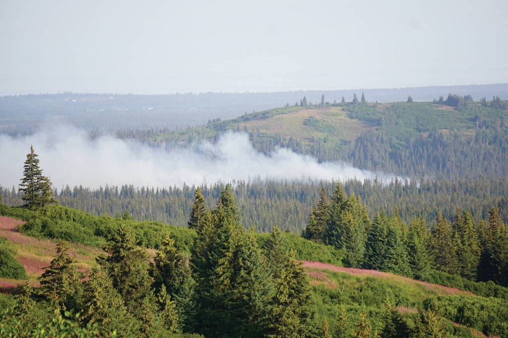
As seen from Diamond Ridge Road at about 6:15 p.m., winds have shifted and are now coming from the southwest, blowing white and pale gray smoke from the North Fork Fire to the northeast up the Anchor River Valley below the North Fork Road hills.
At 4:47 p.m., the Alaska Interagency Fire Information Office issued this update:
“Fire managers report bulldozers were able to get a fireline around the North Fork Fire burning about six miles northwest of Homer in between the North Fork Road and the Diamond Ridge Road. The fire is estimated at 59 acres.
“The two water-scooping Fire Boss aircraft and the air retardant tanker were diverted to a fire near Caribou Lake about 15 miles to the northeast. That fire was estimated at five acres. Suppression efforts are underway on the Caribou Lake Fire.”
There is no other information on the Caribou Lake Fire.
A fire that started early Sunday evening at the south end of the North Fork Road flared up on Monday from about 5 acres to about 25 to 30 acres by the afternoon.
Fire crews responded after the fire was reported about 6:45 p.m. on Aug. 18. Two helicopters with buckets dropped water on the fire on Sunday. A tanker airplane dropped chemical retardant on the fire on Monday.
Fire officials at 1:40 p.m. Monday, Aug. 19, issued a Level 1 “ready” evacuation notice for the Diamond Ridge area to the south and the North Fork Road area to the north of the fire. Firefighters were going door-to-door notifying residents of the alert.
In the Ready-Set-Go set of three alert levels, a Level 1 alert is not a notice to leave.
“Level 1 is the lowest,” said Beth Ipsen, a public information officer with the Alaska Interagency Fire Information Office. “Heads up — there’s a fire in the area. Just be aware of it and start thinking about the next stage.”
“Set” or Level 2 is the next alert status, where people should pack up important papers, medicine, pets and anything valuable they want to take with them. “Go” or Level 3 is the evacuation order.
For information on the Level 1 alert area or information on how to prepare, visit the Kenai Peninsula Borough Office of Emergency Management website at http://kpboem.blogspot.com/2019/08/081919-north-fork-fire-diamond-ridge.html .
The fire started about 1.5 miles east of the intersection of the south end of the North Fork Road and between Miles 164-165 Sterling Highway in the northeast corner of Section 27. It did not initially threaten any structures. There are some homes above the fire in the area where the North Fork Road climbs up what’s locally known as “Thrill Hill,” but the northerly winds are pushing the fire south. The fire is near the Anchor River south of Anchor Point and north of Homer,
Located in the Kachemak Emergency Services Area, KESA firefighters were the first to respond. Anchor Point Emergency Services also responded, as did Alaska Division of Forestry wildland firefighters. A Type 2 Initial Attack Yukon Crew of 15 people responded Monday night.
KESA Fire Chief Bob Cicciarella said the fire has been burning in rough terrain.
“It was hard to get to last night,” he said in a phone interview on Monday morning. “We did get trucks up a very small trail. It’s burned away from that trail right now. That’s what’s making it hard to get to.”
On Monday, two bulldozers were on scene to punch in a road to get larger equipment to the fire and to start putting in perimeter lines, Cicciarella said.
The fire burned in mixed vegetation of grass, shrubs and spruce trees. Cicciarella said some 50-foot tall spruce trees caught on fire on Sunday. He said the fire activity changed quickly. At one point while doing assessment they walked a line of smoldering vegetation.
“By the time we got to the head of the fire and walked back, that trail had 5-foot flames. We had to go from assessing to fighting the fire,” he said.
The unusually warm temperature and extreme dry conditions have made pushed the traditional Alaska fire season of May and early June into August. Fireweed that normally quits blooming at the end of August has already gone to flower.
“The flowers were off them a week ago,” Cicciarella said. “It’s brittle. You can grab it in your hand and it crunches.”
Southcentral Alaska is in a burn suspension, meaning no burn permits can be issued and no burn barrels can be operated.
Winds on Monday are 5-7 mph out of the north. Firefighters were trying to keep the fire out of stands of continuous black spruce which can add more fuel to the fire, Ipsen said.
“They don’t want it to reach that,” she said. “It’s been pretty dry in the area. It will carry a lot quicker.”
Ipsen said fire crews think they have a good handle on the North Fork Fire.
“We’re hoping that this is going to go pretty well and we’ll have some good news pretty soon,” she said.
Cicciarella said since lightning did not strike in the area and there are no powerlines nearby, the cause of the fire most likely was human. The incident is still under investigation.
For more information, call the Alaska Interagency Fire Information Office at 907-356-5511 or visit https://akfireinfo.com/
Reach Michael Armstrong at marmstrong@homernews.com.